.png)
Africa gets bigger on new world map as 164 nations back UN resolution
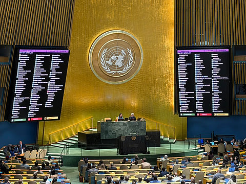
The United Nations General Assembly has approved a resolution supporting the use of a new world map that gives a more proportionate picture of the size of the world's continents. The resolution received backing from 164 countries, while the United States voted against it and six countries abstained.
The map, called the Equal Earth projection, is being promoted as a more accurate way of showing continental land areas. The resolution said it would improve "the accuracy of the cartographic representation of the world."
It also calls on UN member states to use Equal Earth instead of the Mercator projection, which was created by Flemish cartographer Gerardus Mercator in 1569 and was primarily designed for maritime navigation.
Why the map is changing
The Mercator projection is useful for preserving the shapes and angles of land masses, but it does not accurately reflect their relative sizes. As a result, areas farther from the equator can appear significantly larger than they actually are.
Africa and South America, in particular, appear smaller on the Mercator map, while Europe and North America are shown as considerably larger.
The Equal Earth projection, developed by a group of cartographers in 2018, seeks to address that imbalance. It gives more visual space to Africa, Latin America, South Asia and Oceania.
"Equal Earth preserves the relative surface areas of continents and, as much as possible, shows their shapes as they appear on a globe," cartographer Bojan Savric told AFP in 2025.
US objects to UN resolution
Togo, which sponsored the resolution, defended the move by pointing to the influence maps can have on how people understand the world.
"They are therefore never neutral; when they present a distorted image of our planet, they risk perpetuating inaccurate representation that is passed down through generations."
Washington, however, criticised the General Assembly's decision. US representative Yaryna Ferencevych said such discussions were "the reason this institution is losing its credibility."
France, which co-sponsored the resolution, also announced that it would stop using the Mercator projection.
"Changing maps obviously doesn't change the world," Foreign Minister Jean-Noel Barrot said. "But correcting a distorted representation is already an act of truth."


